Īstenojot Riga Port City attīstības projektu, ir būtiski apzināt un novērtēt to kultūrvēsturiskā un industriālā mantojuma daļu, kas saglabājusies Andrejsalas, Rīgas Pasažieru ostas un Jahtu ostas teritorijā, kā arī apkopot vēstures liecības, kas raksturo galvenās norises šajā Rīgas daļā.
Andrejsala
1807. gada ostas plānā Andrejsalas vēl nebija, bet Daugavā iepretim Ķeizardārzam bija atzīmēts sēklis. Tas pakāpeniski audzis, līdz pacēlies virs ūdens un 19. gadsimta vidū ieguvis tiesības saukties par salu. Andrejsalas izbūve jeb tās piemērošana ostas vajadzībām sākās 1881.-82. gadā, kad tika nostiprināts pret Daugavu vērstais krasts apmēram viena kilometra garumā.
Īsumā par Eksportostu un tās rajonu
1901. gadā uzsākās Eksportostas izbūve. Kopš 1908. gada tā kļuva par nozīmīgāko Rīgas ostas daļu, apsteidzot pat Andrejostu. Līdz Pirmajam pasaules karam no tās uz ārvalstīm transportēja pārsvarā kokmateriālus. Brīdī, kad tika dibināta neatkarīga Latvijas valsts, Rīgas osta (arī Eksportosta) pārgāja Finanšu ministrijas Jūrniecības departamenta pārziņā. 1920. gadu beigās noslēdzās Pirmā pasaules kara laika postījumu atjaunošana un turpinājās šīs ostas daļas labiekārtošana – kuģu ceļa padziļināšana, noliktavu būve, granīta krastmalas pagarināšana. 20. gadsimta 20.– 30. gados Eksportosta saglabāja vadošo vietu ostā. Sviesta un bekona eksporta pieaugums Latvijas Republikas laikā aktualizēja aukstumsaimniecības izvēršanu. Līdz 1920. gadu otrajai pusei ātri bojājošās preces varēja uzglabāt tikai 1902. gadā Andrejostā uzbūvētajā angļu sabiedrībai „Union” piederošajā saldētavā. No 1925. līdz 1928. gadam par valsts līdzekļiem Eksportostā uzcēla trīsstāvu saldētavu, kura kļuva par galveno ēku ostā.
Ielūkojies zemāk esošajās prezentācijās, lai iegūtu vairāk informācijas
- I daļa Andrejsalas rašanās. Daugavas pārveidošana. Infrastruktūra. Ielas
- II daļa Teritorijas izmantošana. Starp diviem Pasaules kariem. II Pasaules karš. Andrejsala pēc II Pasaules kara
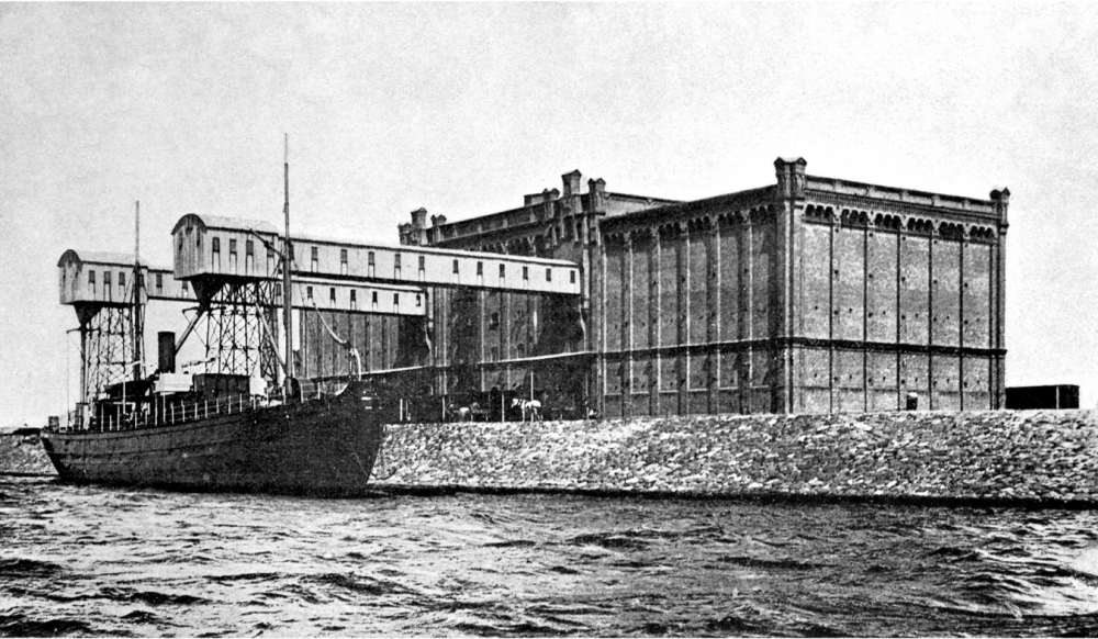
- III daļa Piestātnes un ūdens ceļi. Pasažieru kuģīšu satiksme. Tirdzniecības ostas attīstība. Siļķu brāķis. Rīgas ostas elevatori
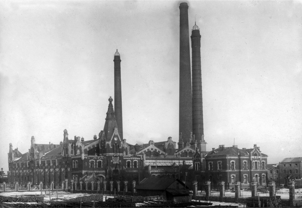
- IV daļa Dzelzceļš. Stacija Rīga-Krasta. Union saldētava. Andrejsalas spēkstacija
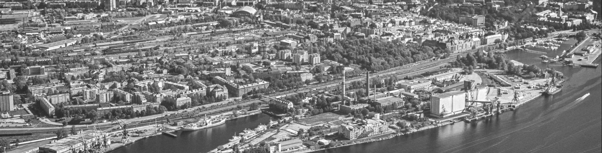
Pašlaik Andrejsalas teritorijā darbojas dažādas nozares uzņēmumi.
*Avots: Rīgas Vēstures un kuģniecības muzeja pētījuma un izstādes “Andrejsala laika griežos” materiāls.